- Home
- Learn
- Weather Systems - Weather Information Portal
Weather Systems - Weather Information Portal
Weather Systems vary greatly in terms of scale and duration
The major weather systems affecting Singapore that can lead to heavy rainfall are:
- Localised thunderstorms/showers caused by strong daytime heating of the earth’s surface
- Sumatra squalls, an organized line of thunderstorms that typically develop over Sumatra island or the Straits of Malacca
- Monsoon surges, a strengthening of winds in the Northeast Monsoon flow
These systems produce showers or rain, or a combination of both. Both terms are sometimes used interchangeably, but there are subtle differences.
Showers fall from convective clouds (cumulus or cumulonimbus) and are more intense and short-lived, typically lasting for an hour or two. This is the most common form of precipitation in the tropics.
Rain falls from layered clouds (stratus), is long-lived, and may persist for several hours and even days. Rain is common in the wake of a Sumatra squall and during a monsoon surge.
Thunderstorms are the most powerful of everyday weather events, and can bring heavy rain, lightning, and sometimes hail. Most thunderstorms are associated with towering cumulonimbus clouds.
Formation of thunderstorms
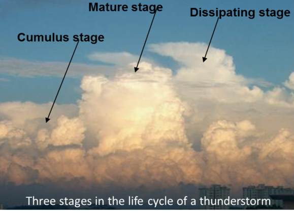
Cumulonimbus clouds normally form on warm, sunny days. Solar radiation heats the earth’s surface during the day, which in turn warms the lowest layer of air. As the warm and humid air rises, it cools and condenses to form clouds, which grow larger and larger as more warm air rises. This convective process is instrumental to the formation of thunderstorms in the tropics.
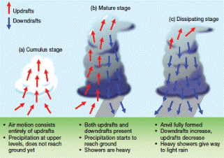 Three stages of a thunderstorm development
Not all cumulonimbus clouds bring thunderstorms; some just bring moderate to heavy showers. On average, an individual cumulonimbus cloud takes about an hour to grow and dissipate, and produces less than thirty minutes of thunder and lightning. If a thunderstorm lasts longer than this, it is probably because there is more than one cumulonimbus cloud present.
Thunderstorms occur all year round in Singapore, but are more prevalent during the inter-monsoon periods (April-May and October-November). This is when light and variable winds favour the development of localised thunderstorms in the afternoon and evening. On average, Singapore experiences about 167 thunderstorm days and 176 lightning days a year.
Accompanying phenomena
Apart from heavy rain and strong winds, the most common phenomena associated with thunderstorms are lightning and thunder. Less common phenomena are microbursts, hail and waterspouts.
Lightning is a large electrical spark of very short duration during a thunderstorm. Inside a thunderstorm cloud, an enormous electrical charge slowly builds up; the charge is then discharged in a blinding flash, as lightning zig-zags between ground and cloud.
There are three types of lightning: intra-cloud lightning, inter-cloud lightning, and cloud-to-ground lightning. Intra-cloud lightning is the most common while inter-cloud lightning is the least common. The most dangerous type, cloud-to-ground lightning, makes up about 20% of all lightning. Inter-cloud lightning is often a precursor to cloud-to-ground lightning.
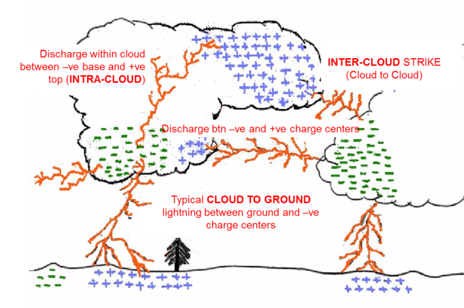 Schematic diagram showing the three types of lightning discharges
Singapore has an average of about 176 lightning days per year. A lightning day is defined as a day when at least one lightning occurrence is detected at the Changi climate station. The highest incidence of lightning activity typically occurs in November followed by April and May. These are the Inter-Monsoon months when the predominantly light and variable winds favour the development of localised and intense thunderstorms. On average, the Inter-Monsoon months account for more than 50% of the lightning strokes in a year.
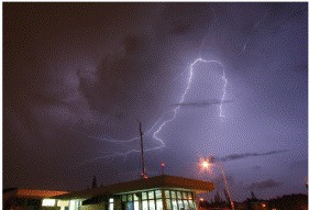 Cloud-to-cloud lightning observed from Changi Meteorological Station
Most lightning strokes occur within 5-6 km of a thunderstorm cloud. In the absence of a thunderstorm in a location, lightning strokes from a distant thunderstorm cloud more than 10 km away could still affect that location. Such a lightning strike is known as a “bolt from the blue”.
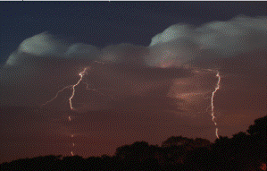 Cloud-to-ground lightning observed from Pasir Ris
In Singapore, a network of four lightning detection sensors island-wide detects the three types of lightning. Real-time lightning information from the sensors is available via:
Smartphone apps: myENV
Lightning Information Service website
24hr automated weather hotline: 6542 7788
As Singapore has one of the highest lightning strike rates in the world, it is important to take precautions during thunderstorms. You can download our lightning safety posters here:
Lightning safety poster 1
Lightning safety poster 2
Thunder is the sharp or rumbling sound which accompanies lightning. It is caused by the intense heating and expansion of the air along the path of the lightning. The rumble of thunder is caused by the noise passing through layers of the atmosphere at different temperatures.
Rain falling from a thunderstorm cloud can drag the surrounding air downwards to produce a downdraft. This downdraft in turn spreads out upon reaching the ground, resulting in gusty winds that can cause damage to the surrounding area if the downdraft is intense and strong.
A microburst is an intense downdraft that occurs over a small localized area, typically with a horizontal extent of less than 4 km. They have a brief lifespan reaching maximum intensity within 10 minutes, and can generate wind speeds of more than 270km/h.
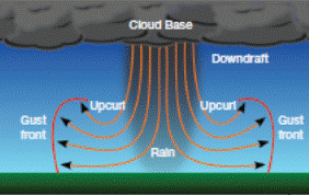 Schematic of a microburst with its characteristic “curling of air” upon strong impact with the ground
As a microburst is a small scale feature that forms and dissipates very quickly, it remains a challenge to forecast when a microburst will occur, and to issue timely warnings of its expected occurrence. Furthermore, as there are a limited number of wind sensors across the island, it is not possible to detect the occurrence of microburst in every part of the island.
Hail stones form in an intense thunderstorm (cumulonimbus) cloud when raindrops freeze at high levels and then grow steadily in size as they are recycled through powerful updrafts and downdrafts, or strong vertical winds. They compose of transparent irregular ice pieces or alternating layers of ice, ranging in size from a few millimetres to a few centimetres in diameter. Once a hailstone becomes too heavy to be supported by the thunderstorm’s updraft, it falls out of the cloud.
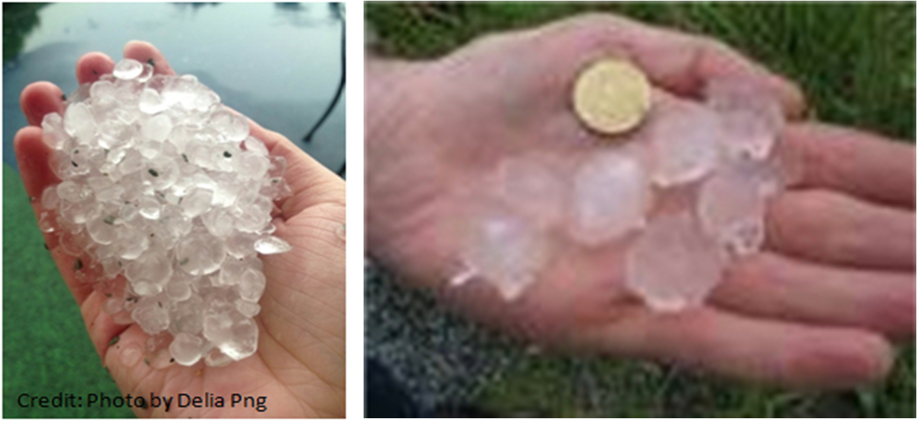 Hailstones during an intense thunderstorm event in 2013 (left) and 2008 (right)
In the tropics, the atmosphere is often warmer with the freezing level usually at altitudes greater than 5 km. Therefore, hail formed in the upper atmosphere usually melts before reaching the ground. However, it is still possible for hail to form under particularly strong updrafts of intense thunderstorms, with the updrafts carrying and sustaining the growth of hail high up in the atmosphere. Correspondingly strong downdrafts help to drive the hail down to the ground before it has completely melted.
Sightings of hail stones have been reported in Singapore every few years on average. Hailstones that reach the ground here tend to be small compared to those formed in the mid-latitudes.
A waterspout is a rotating column of air often associated with intense thunderstorms over the sea. They have a similar appearance to tornados but they are generally weaker and not as destructive as their land counterparts.
Also known as funnel clouds due to their thin column-like or funnel appearance, they are small scale systems with an average diameter of 50 m. The waterspout may appear to be drawing water into its column, but it is actually water droplets in a rotating vortex of air. As the air rotates and rises, the humid air cools and water vapour condenses, making the whirling mass visible.
The average lifetime of waterspouts is about 10 minutes, but the large ones can last for up to one hour. Moving at speeds of up to 30 km/h, they tend to lose their energy quickly upon nearing the coast. At sea, they can produce strong wind gusts of 40 – 80 km/h, and put swimmers and small vessels at risk.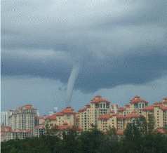
Waterspout observed over waters off the southern coast of Singapore
(Photo credit: Lyn Chua)
An average of three occurrences of waterspouts has been observed in waters off Singapore each year.
A Sumatra squall is an organised line of thunderstorms that originate over Sumatra Island or the Strait of Malacca, and typically move eastward towards Singapore and the surrounding region under the influence of southwesterly or westerly winds.
It commonly occurs during the Southwest Monsoon and Inter-monsoon periods, and usually affects Singapore overnight or in the morning. A Sumatra squall is often characterised by a sudden onset of strong gusty surface winds of 40 to 80km/h and heavy rain lasting from 1 to 2 hours as it moves across the island. Maximum gusts* of up to 93 km/h have been recorded during the passage of a Sumatra squall.
[*Gusts are sudden brief increase in wind speed]
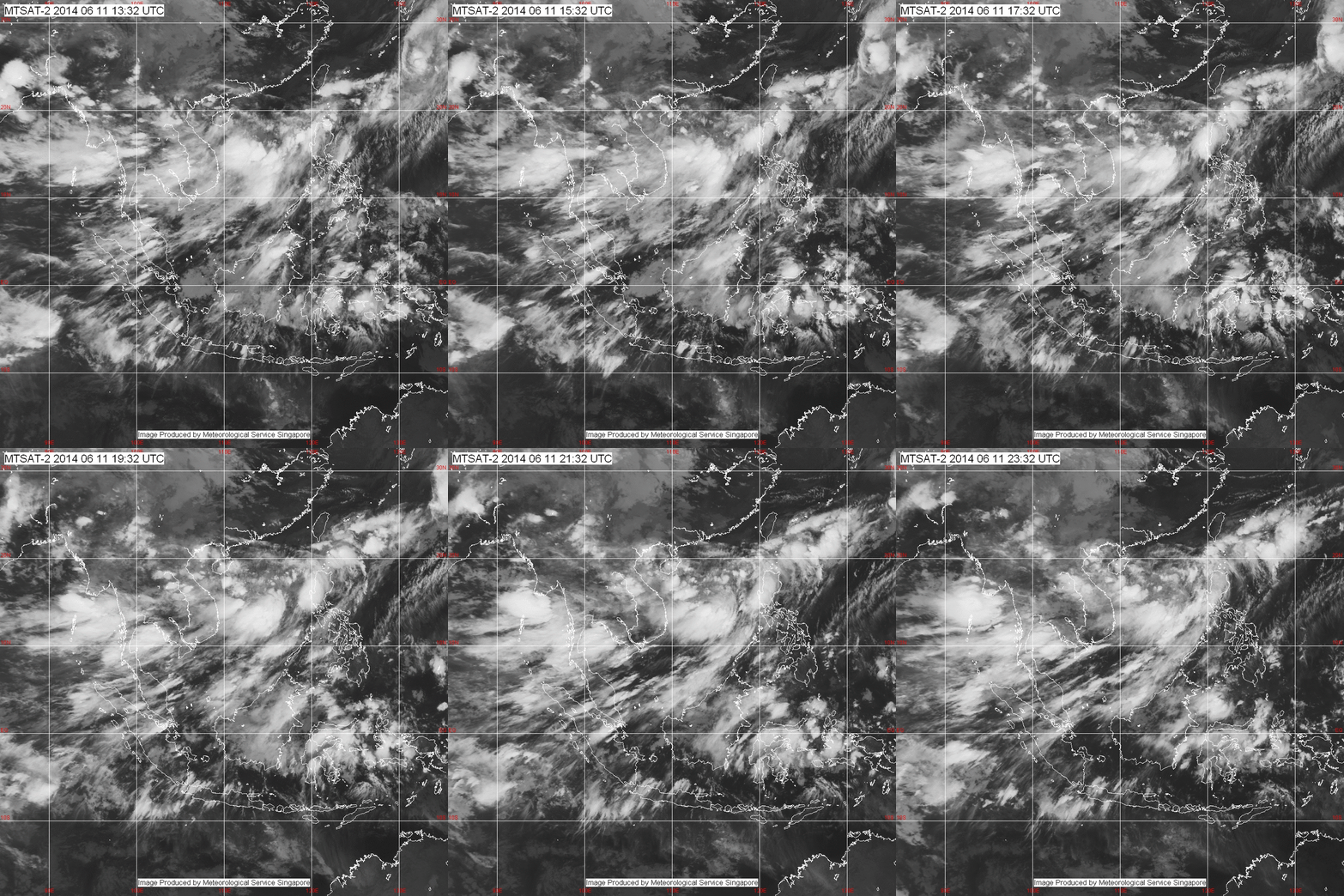 Satellite animation of a Sumatra squall affecting Singapore in the predawn hours
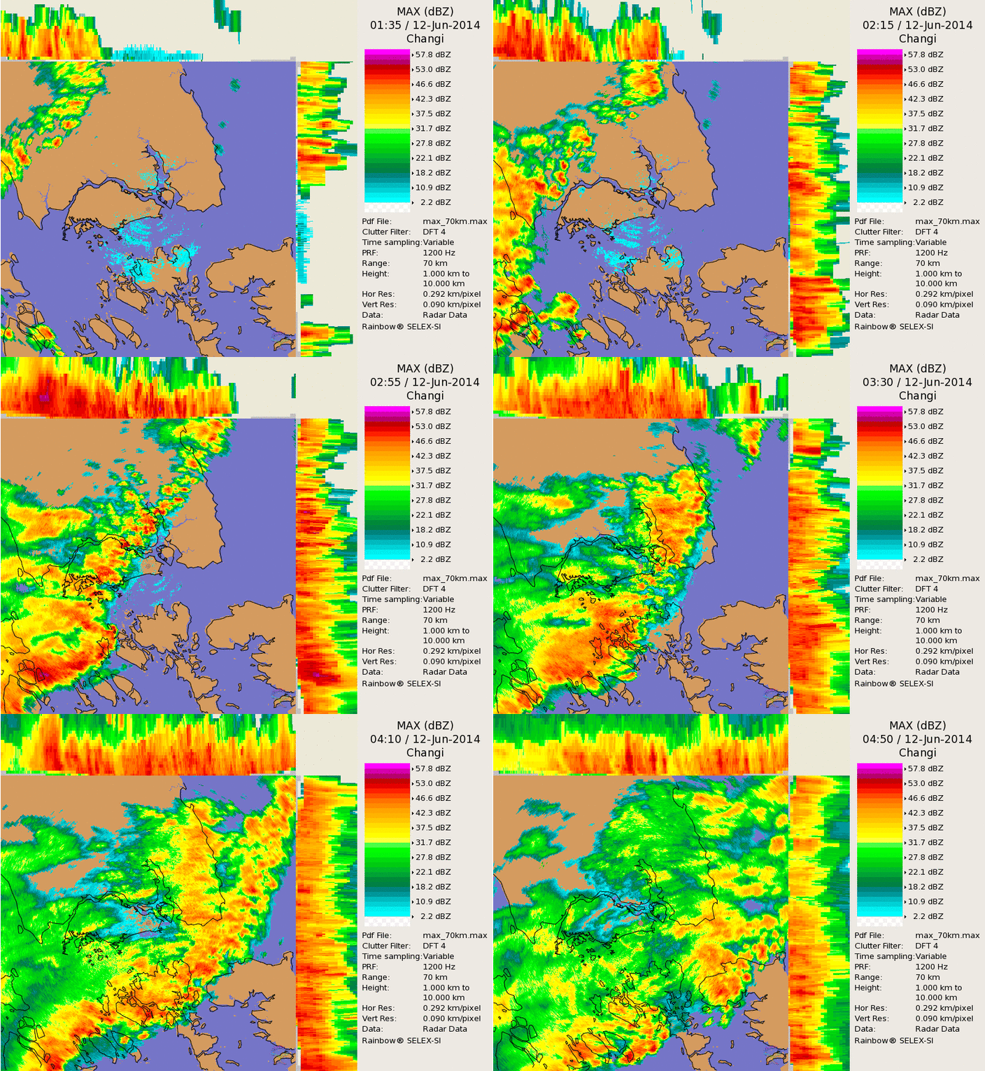 Radar animation of a Sumatra squall affecting Singapore in the predawn hours
During the northern hemisphere winter (December – March), high pressure systems frequently develop over continental northern Asia, and bring dry conditions and cold subsiding air over the northern Asian landmass. At times, a sudden increase in wind speed causes the cold subsiding air to surge southwards into the South China Sea towards low pressure systems in the southern Hemisphere. This sudden surge of cold air is referred to as a Northeast Monsoon surge.
As the cold winds surge southwards over the South China Sea, it warms and gathers moisture, leading to the formation of dense rain clouds over the equatorial region. On occasions when the winds are particularly strong, they can bring moderate to heavy showers/rain and occasional thunderstorms to coastal regions in Southeast Asia such as Vietnam, Peninsular Malaysia, and Singapore. The showers can be continuous and prolonged, lasting from 2 to several days. The Northeast Monsoon Surges occur more often and are more intense during the early part of the Northeast Monsoon season (November – January) than in the latter half of the season (February – March). Surges that occur during the dry phase of the Northeast Monsoon typically bring strong winds but there are no accompanying showers.
On average, Singapore experiences 2 to 4 monsoon surges each year. Each event can last between 1 and 5 days where widespread continuous moderate to heavy rain affects the island. Sometimes the surges come in spells with breaks of cloudy or overcast conditions.
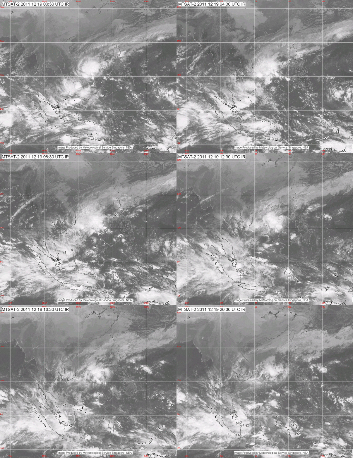 Satellite animation showing widespread monsoon rain affecting the South China Sea and affecting Singapore due to a Monsoon Surge
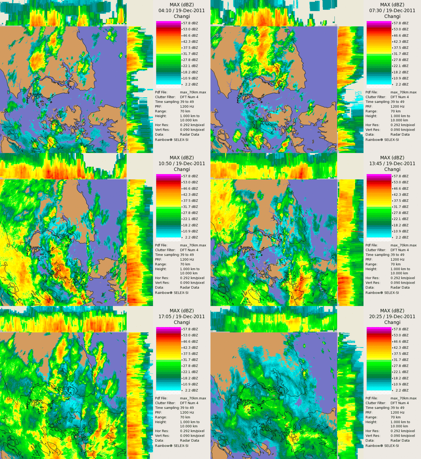 Radar animation showing multiple spells of showers affecting Singapore during a Monsoon Surge
