Clouds - Weather Information Portal
- Share this page


Clouds come in a myriad display of shapes and sizes
Clouds form when moist air is cooled to such an extent that it becomes saturated. The main mechanism for cooling air is forcing it to rise. Because the pressure decreases with height through the atmosphere, air expands as it rises and therefore cools. Eventually it may become saturated and the water vapour then condenses into water droplets to form cloud. If the temperature reaches below about -20 deg C many of the water droplets would have frozen so the cloud is mainly composed of ice crystals.
There are four main ways in which moist air can be lifted to form clouds:
- Rapid ascent when heated air at the earth’s surface rises in the form of thermal currents (convection)
- Slow widespread ascent where warm moist air is undercut by cold air
- Upward motion associated with turbulent eddies resulting from friction on the earth’s surface
- Air forced to rise over a barrier of mountains or hills
In the tropics, the first way is the most common and tends to produce cumulus-type clouds.
There are ten basic cloud types which can be categorised according to the height of their base above the ground: low clouds, medium clouds and high clouds. They are given Latin names which describe their characteristics e.g. cirrus (a hair), cumulus (a heap), stratus (a layer) and nimbus (rain-bearing).
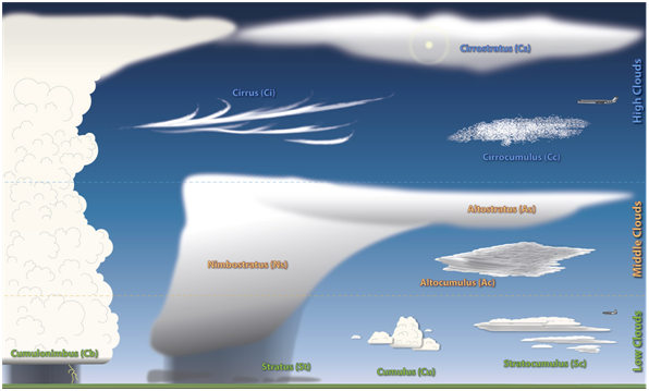
The ten basic cloud types (Image credit: NOAA)
All clouds are white but when viewed from the ground some appear grey according to their depth and shading from higher cloud.
Low clouds are usually composed of water droplets, though cumulonimbus clouds include ice crystals, and have a base below 2 km.
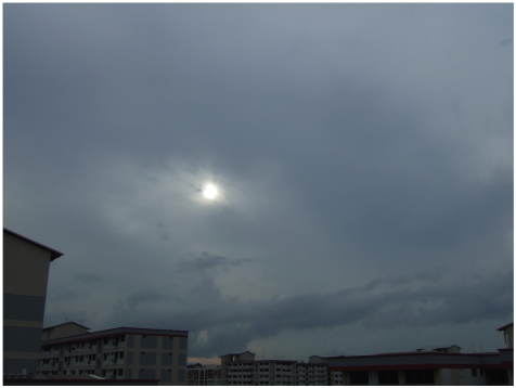
Stratus
Stratus clouds are low, grey clouds that typically form in sheets or layers, often obscuring the tops of tall buildings.
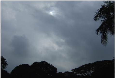 Patches of ragged stratus over
Changi
In Singapore, shallow fog or mist often forms in forested areas during the night. At daybreak, the mist lifts to form patches of stratus gradually rising above the ground. Ragged patches of stratus, called stratus fractus, can also form beneath rain clouds (e.g. cumulonimbus). This is often seen here during periods of prolonged rain experienced in the Northeast Monsoon.
Cumulus
Cumulus clouds are easy to recognise — they appear as white, fluffy clouds that float across the sky on a sunny day. They are the visible sign of thermal currents that rise from the ground when it is heated by the sun. In the early part of the day, cumulus clouds often resemble small puffs of cotton wool, and usually evaporate as their moist air mixes with the drier surrounding air.
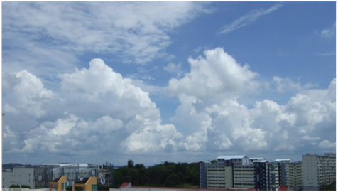 Cumulus clouds as seen over blocks of flats
In the tropics, actively developing cumulus clouds often appear in close clusters and combine to form clouds that are deeper and have a larger extent. Such clouds evolve into tall towers known as cumulus congestus, or towering cumulus. These in turn may continue to grow into cumulonimbus clouds.
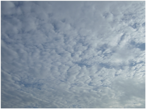
Stratocumulus
Stratocumulus clouds appear as grey or whitish sheets. As the name suggests, these can be thought of as combinations of stratus and cumulus clouds. They have a definite structure in the form of rolls or clumps, sometimes bearing resemblance to pancakes. The clouds’ lumpy appearance indicates that some weak convection is occurring inside.
 Stratocumulus observed over Singapore
Stratocumulus is one of the most common cloud types worldwide, and occurs over large areas of the oceans.
Cumulonimbus
Cumulonimbus, or thunderstorm cloud, is the tallest and most dramatic in appearance. It is classified as a low cloud because its cloud base is usually below 2 km, but it actually extends in its entirety up to 15 km high in the tropics.
 Cumulonimbus
with its anvil-shaped top sheared by higher level winds
A cumulonimbus can be considered as a bigger, better organized version of the cumulus. But there is one important structural difference in that the uppermost levels of the cumulonimbus have turned to ice and become fibrous in appearance, whereas cumulus are composed entirely of water droplets. The icy section at the top may flatten out into an “anvil” shape when the cloud is fully developed. At this stage, the base is usually dark, with showers of rain or hail falling. The showers are often quite heavy for short periods, and lightning and thunder sometimes occur. The lifetime of a cumulonimbus is usually less than one hour, but can last longer if it managed to regenerate itself under certain meteorological conditions.
Medium clouds are usually composed of water droplets or a mixture of water droplets and ice crystals, and have a base of between 2 km and 7 km.
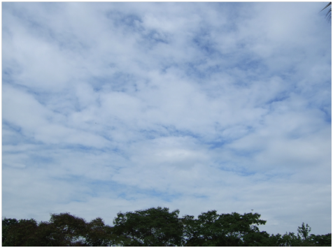
Altostratus
Altostratus clouds are relatively featureless sheets of cloud that may cover all or part of the sky, and may be thick enough to block out the sun or thin enough for the sun to shine through. Optical phenomena such as iridescence can also be observed through thin altostratus.
In the tropics altostratus clouds usually form from the remnants of convective weather systems that have since dissipated.
 Altostratus Clouds
Altocumulus
Altocumulus consists of rounded, individual masses with clear sky showing between them. In the tropics, altocumulus, like altostratus, usually comes from the remnants of a convective system such as a thunderstorm. The difference
between altocumulus and altostratus is that in altocumulus, some instability is present such that weak convection takes place, giving rise to individual convective cells.
Altocumulus can consist of both water droplets and ice crystals, hence exhibiting a variety of optical phenomena, depending on whether liquid water or ice is predominant. Such phenomena include iridescence and mock suns.
 Altocumulus clouds
High clouds are usually composed solely of ice crystals and have a base between 5.5 km and 14 km.
Cirrus
Cirrus stretches across the sky in delicate white filaments. It consists almost entirely of ice crystals, which is what gives them their wispy or feathery appearance.
In the tropics, cirrus often comprises the remnants of decayed thunderstorms; the anvil of a cumulonimbus cloud is actually a large shield of cirrus. Since upper level winds are usually strong, these cirrus cloud tops are often carried far downwind from the thunderstorm. Dense and extensive patches of cirrus often persist long after the parent cumulonimbus cloud has dissipated.
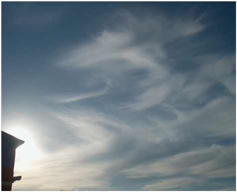 Cirrus clouds appears as feathery streaks across the sky
The precipitation from cirrus never reaches the ground; because cirrus is so high up, the ice crystals falling from it usually fall into warmer air at lower levels, where they melt and evaporate before reaching the ground.
Cirrostratus
Cirrostratus is so thin that it often goes unnoticed, partly because it has little effect on sunlight. Because of this, it is probably the least recognised of cloud forms, although it is relatively common. Should the sky assume a slightly milky appearance, it is possible that a thin veil of cirrostratus has formed overhead.
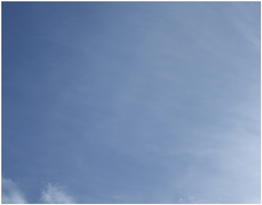 Cirrostratus spreading across the sky
Cirrocumulus
Cirrocumulus consists of many small cloud elements, which are shaped like tufts and ripples.
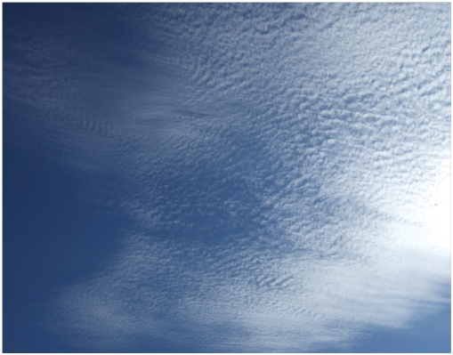 Cirrocumulus with small elements shaped like tufts and ripples
One way to recognise cirrocumulus is by the shading of its elements. Unlike altocumulus and stratocumulus, the individual cloud elements do not show any shading. Like other clouds in which some cumulus structure is present, convection is occurring in the cloud, giving it its cellular appearance.